News

News

COLLEGE EVENT

UP Tacloban GIS classes organized a Hazard Maps Exhibit

28 November 2025

UP Tacloban’s CMSC 154 (Fundamentals of Geographic Information Systems) and FISH 134 (Geographic Information Systems and Remote Sensing for Fisheries) classes organized a map exhibit on 26-27 November 2025 at the Leyte Samar Heritage Center Gallery.
 
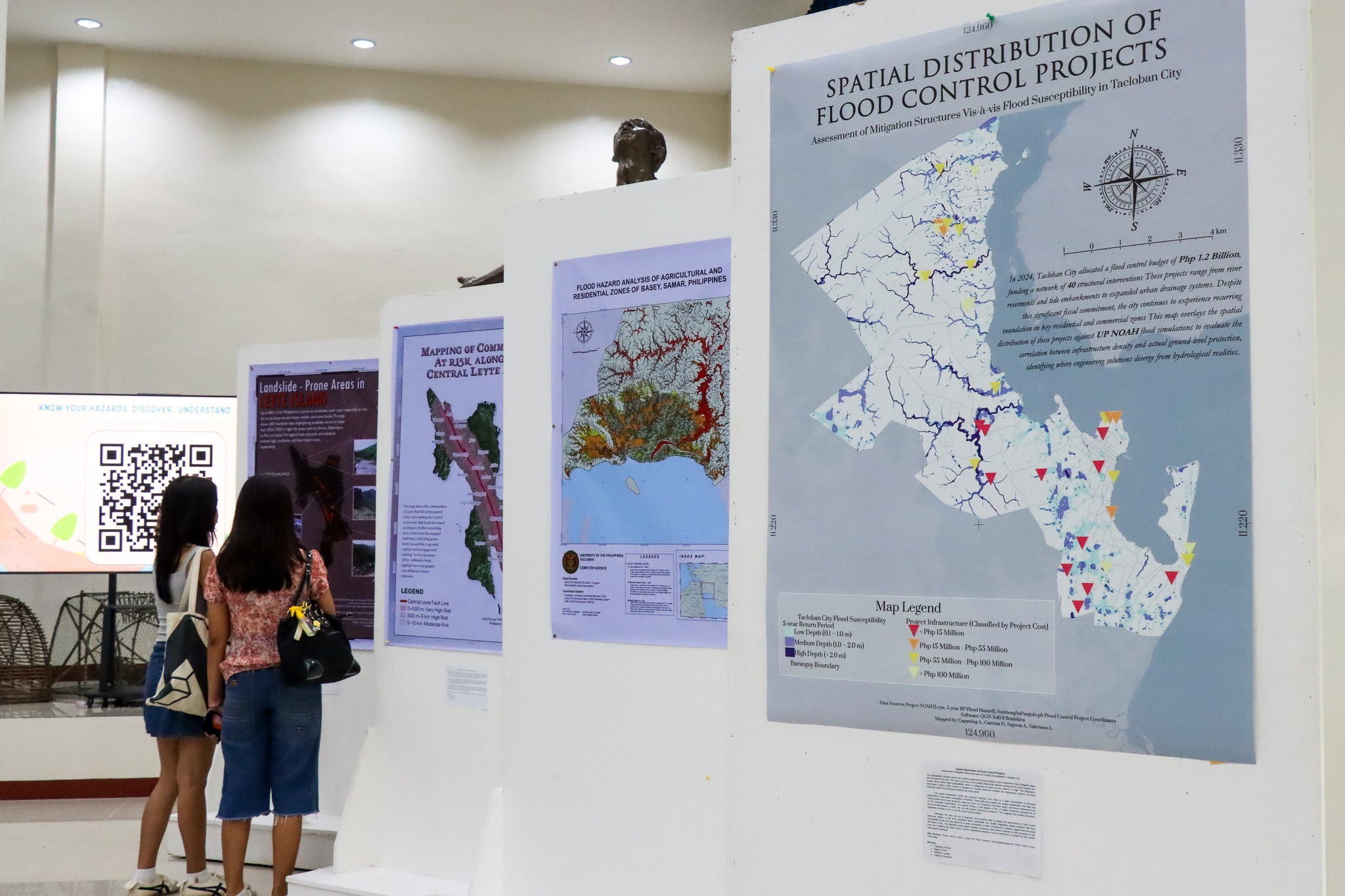
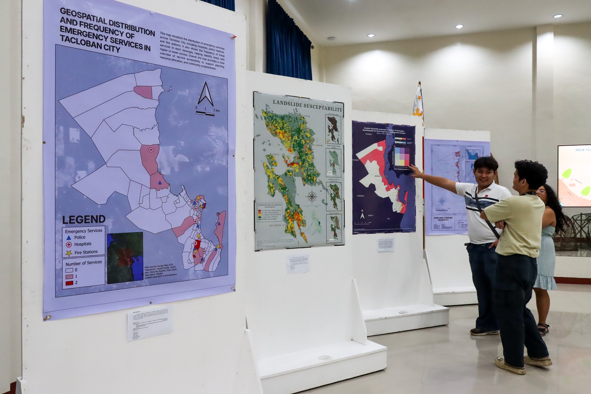
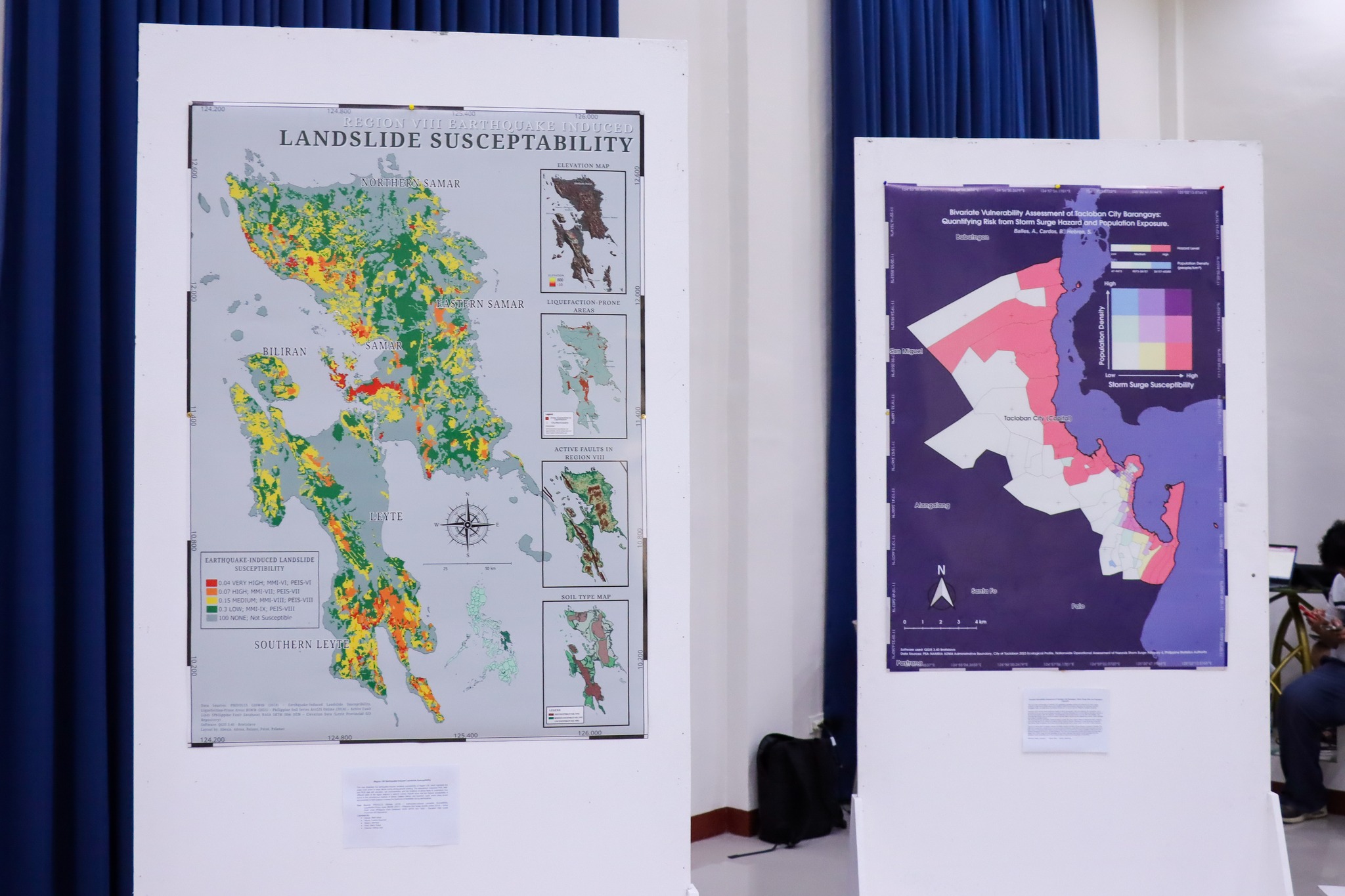
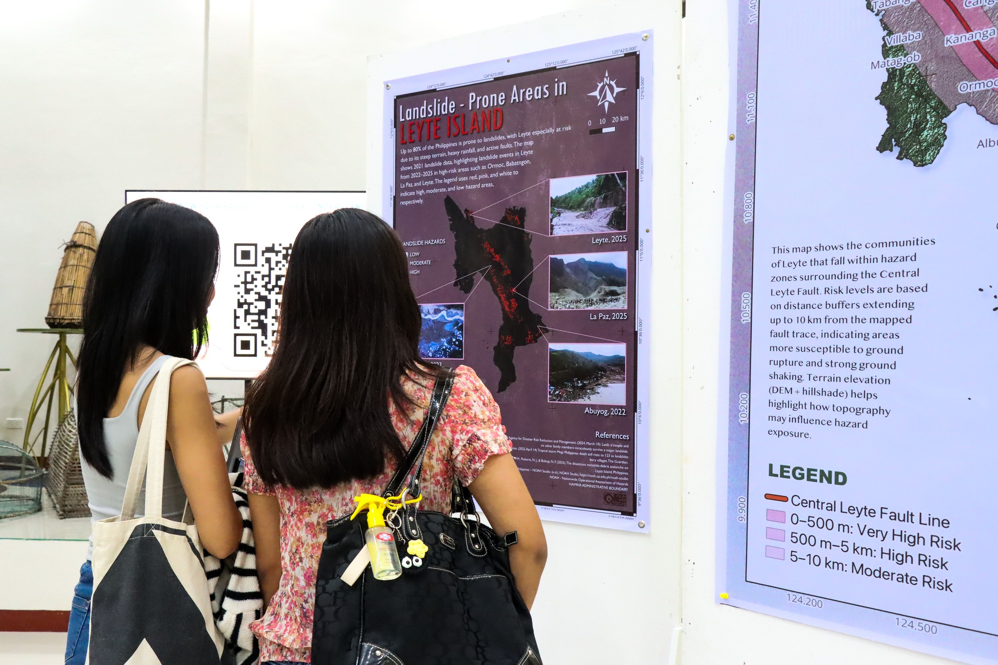
The exhibit showcased student-produced maps of natural hazards, community vulnerabilities, and disaster preparedness across Leyte and Samar. By visualizing floods, storm surges, landslides, earthquake-prone areas, emergency services and evacuation centers, and flood control measures against vulnerable areas, the maps highlighted regional risks and provided essential tools to strengthen local disaster response, resilience, and planning.
 

Share this article:

Related stories:

592902658_1373066054833586_8881596612636559166_n
UP Tacloban College - Paglamrag 2025
All are invited to Paglamrag 2025, the lighting of...
Read More
587408559_1463486939119588_7057395126547788810_n
UP Tacloban joins the nationwide 18-Day Campaign to End Violence Against Women (VAW)
UP Tacloban joins the nationwide 18-Day Campaign to...
Read More
584433551_1361979282608930_1631123803651957679_n
UP Tacloban Children’s University
The UP Tacloban Children’s University will be launched...
Read More